At 6:00am we headed off into the dark. By then the sky was beginning to get light but for about thirty minutes I was glad I had my headlamp. The first 4 miles is a gentle climb of about 1,100 ft. so I alternated walking and running. We reached Marlette Lake and the trail circled around the South end of the lake before starting the climb up to Hobart aid station at mile 6.
Right after Hobart we crossed the first two snow fields as we circled around Marlette Peak a couple of hundred feet below the summit. Normally, this is one of the best views on the course. We were 1000 feet above Marlette Lake and Lake Tahoe is 2,500 feet below us. Unfortunately the view was mostly obscured by thin clouds so I got few pictures the first morning. Here is a shot I took on the way up before ascending into the clouds.

Here is a short video of the section in the picture above. In the video you will see Joey Anderson in
front of me taking his video (Linked to below) and James Plant about to run over me at the end.
front of me taking his video (Linked to below) and James Plant about to run over me at the end.
Here is a link to a video posted by Joey Anderson, The guy I ended up racing with the last 5 miles of the run. I am right behind him as he was shooting the part crossing the first snow field and videoed him as he was filming this and the next shot. YouTube - Tahoe Rim Trail 100. Joey's video starts at daylight and ends at the Tunnel Creek aid station at mile 11.
At about mile 11 we reached the Tunnel Creek aid station for the first time. Runners in the 100 mile race will pass through this aid station 6 times. The course looks like a double ended lolly-pop with an appendage off the right side. We reach Tunnel Creek at miles 11, 17.3, 35.3 on the first lap and miles 61.2, 67.5 and finally at mile 85.5. We get to know the aid station volunteers pretty well by the final visit. Outbound is when we ran the Red House Loop. On the return trip we ran straight back on the TRT ( Tahoe Rim Trail) to Hobart aid station and skip the Red House Loop. Below is the course map.

After Tunnel Creek (outbound,) the course drops down the 6.3 mile Red House Loop. It starts with a very steep descent of about 1,300 feet followed by numerous stream and bog crossings. Then we start the long climb back up culminating in a 700 ft climb in about 3/4 mile near the aid station. Finally we reach a gentler part of the climb for the last few hundred yards back to Tunnel Creek. We are weighed upon the return to Tunnel Creek to be sure you are drinking enough water, but not too much. Both are bad.
From there we continue north along the Tahoe Rim Trail about 6 miles further. This section is probably the most scenic of the entire race. The trail traverses back and forth on one side of the ridge line then the other for miles. The views of Tahoe to the west and Washoe Valley to the east are beautiful. We pass the Bull Wheel aid station (at the top of Diamond Peak Ski Resort) and on to the Incline Creek trail junction where we drop down the mountain toward Lake Tahoe and the Diamond Peak aid station.
View of the Washoe Valley side, Lake Washoe and a little of Carson City off to the far right.

One of many ridge crossings through huge granite boulders.

And back over to the Tahoe side, looking down at Incline Village and the north shore of Tahoe.

The Bull Wheel aid station is a vary basic aid station. Everything must be brought up form Diamond Peak Resort. I am not sure how they got everything up there. The resort may have provided some type of vehicle that could climb the road straight up a ski run, but I certainly don't know what type. From there we continued on across the TRT for about 3 more miles before dropping 2,000 feet down the mountain in 4 miles to the Diamond Peak aid station located at the main lodge at the ski resort at mile 30.5.
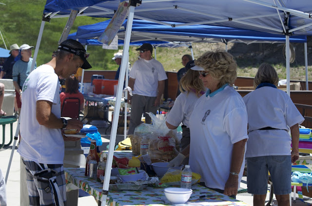
The picture of Diamond Peak Aid Station shows just a part of the "spread" which including everything from soup to sandwiches and quesadillas made to order to"veggie things" and a lot more. I arrived here just about 12:30pm. Good place to be at lunch time. (I borrowed this picture.)
Marye Jo had all my gear out on a table ready for me when I arrived. I gathered what I needed and in about 5 minutes was headed out of the Diamond Peak AS. It was now early afternoon and the sun was intense as I started the climb up from Diamond Peak I was carrying a coup of soup, a 1/4 sandwich and an orange (or maybe a banana, I can't remember which.) It is a lot more efficient to eat while walking rather than wasting time sitting in a aid station.

I don't know who took this picture but I had not started using the poles yet because I was still eating.

After leaving Diamond Peak we started the steepest climb I have ever done in a 100 mile race, with the exception of about 100 ft of Chinscraper at the top of the first climb in the Wasatch 100. We start up a resort service road, shown above that climbs steadily for a while then joins the Crystal Ridge ski run and heads straight up the run. The road climbs 1,700 feet in just under two miles, which isn't to bad, except that the first mile is a reasonable climb. Here are a few pictures.
Down low on the reasonable section of the climb.

Note how people are doing all kinds of zig-zagging up the hill.
This in NOT a REASONABLE section!

Of course, in the video it doesn't even look steep.
Here is Part 2 of Joey's Tahoe Rim Trail 100. It starts with the Red House Loop and ends with the climb up from the Diamond Peak Resort Aid Station to the top of Diamond Peak. At the top you can see Bull Wheel aid station down the hill.
It probably took close to an hour to make the climb to the top of the Crystal Ridge lift. This section is totally exposed to the sun and it was hot! It was quite a relief to finally reach the top and be back on the trail again. We started back along the TRT, this time headed south, past Tunnel Creek AS for the third time that day and on to Hobart,at mile 40.3, for the second time today. All along the north side of the ridge line we climbed over snow field after snow filed. Some were small enough we could bypass but most were not. The largest fields were along the trails on the north side near the ridgeline. When we crossed them this morning, they were still frozen. On the way back in the afternoon they had become soft, slick, and treacherous. One step out of the dirty path or chopped steps would at best, land you on your butt in very wet and cold snow. At the worst, send you sliding down the the hill in a hurry. Here is a nice example of what we spent a lot of time running and hiking over.

There is one other disadvantage to running through wet snow. Your shoes stay wet. My shoes were dry until the stream crossings at the bottom of Red House Loop early in the morning. They were still a little damp as the snow fields began to soften as the temperatures rose in the late morning. They never dried completely by the time we were tramped across the snow in the afternoon. Actually, they never fully dried out the rest of the afternoon and all night. One of the larger snow fields near Hobart was very steep and steps had been chopped into the side for about 20 feet. By the time I reached this section in the afternoon the steps were gone and all that was left was a "slide." There was no way down except to sit in the snow and "schuss" down the slope. Warning, this can be a little unpleasant in running shorts.
After Hobart the trail splits and we head to the left for a gentle 1,000 climb over about three miles to the Snow Valley Peak aid station. As the name suggests, there was a lot of snow.

Snow Valley Peak is the high point of the course at about 9,000 feet.

The Snow Valley Peak aid station is run by the Carson City Boy Scouts and they do a super job. They greet you way before reaching the AS to find out what you need. They have everything you could need despite being in a very remote area, located right on the ridgeline. I don't know how they ever secured the shelter up there because the wind was howling both time I passed through. They even had "sorbet."
From here, we had a long, 5.4 mile descent to Spooner Lake trail head, then a flat 1.7 mile sprint to the halfway point at the Spooner Lake aid station at mile 50.2. (I thought that was the longest 1.7 miles I had ever run, that is, until the second lap.) About 2 miles out the lake comes into view and the trail drops down along the shore line for a short distance. The aid station is visible just across the lake. You can even hear people yelling and music playing. You don't seem to ever get there thought. But I finally did and I was quite happy.

I was really glad to see Marye Jo. She gives me a reason the "get there!"

I was at 50.2 miles (HALF WAY) and running on a 30 hour pace. I knew I would loose some time over night, but I was still hoping to finish close to 31 hours. I added an additional layer of clothing because I knew it was going to be cold along the ridge line.

It was going to be a long, cold night, but I was ready.
Next Installment, Lap 2.
No comments:
Post a Comment